
The Business Research Company’s report on the Aerial Imaging Market provides insights into the global market size, growth rate, regional distribution, competitive landscape, key segments, emerging trends, and strategic opportunities.
What are the key drivers behind the aerial imaging market’s growth in recent years?
Growing incidents of natural disasters are expected to propel the growth of the aerial imaging market. Natural disasters are sudden and terrible events in nature changes such as a hurricane, tornado, or flood mainly due to climate that usually results in serious damage and many deaths. Aerial imaging helps to take prompt on-ground action, much faster than manual detection, analysis, and action to reduce further damages while reducing response time. Due to growing incidents of natural disasters, there will be an increasing demand for aerial imaging solutions to manage the situations. For instance, in January 2024, a Switzerland-based Tink Tane company, according to the World Economic Forum, By 2050, climate change could result in an additional 14.5 million deaths and $12.5 trillion in economic losses globally. Thus, the growing incidents of natural disasters are expected to drive the growth of the aerial imaging market.
Access Your Free Sample of the Global Aerial Imaging Market Report – Get Insights Now!
https://www.thebusinessresearchcompany.com/sample.aspx?id=6695&type=smp
How does the future projection of the aerial imaging market size compare to its historical growth?
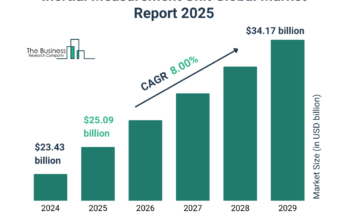
The aerial imaging market size has grown rapidly in recent years. It will grow from $3.94 billion in 2024 to $4.52 billion in 2025 at a compound annual growth rate (CAGR) of 14.6%. The growth in the historic period can be attributed to increased infrastructure development, rise in precision agriculture, global connectivity and remote work, regulatory support, economic growth and industrial expansion.
The aerial imaging market size is expected to see rapid growth in the next few years. It will grow to $8.21 billion in 2029 at a compound annual growth rate (CAGR) of 16.1%. The growth in the forecast period can be attributed to rise in urbanization sector, growing real estate industry, rising smart city initiatives, rise in tourism and entertainment sector, rising disposable income. Major trends in the forecast period include artificial intelligence and machine learning integration, 3D modeling and photogrammetry, augmented reality (ar) applications, 5g connectivity, customized solutions.
Gain Exclusive Market Insights—Customize Your Research Report Today For Fast Delivery!
https://www.thebusinessresearchcompany.com/customise?id=6695&type=smp
Which key players are shaping the future of the aerial imaging market?
Major companies operating in the aerial imaging market include Digital Aerial Solutions LLC, Airobotics Ltd., Cooper Aerial Surveys Co., EagleView Technologies Inc., Fugro N.V., SZ DJI Technology Co. Ltd., 3D Robotics Inc., Aeromao Inc., Aerovel Corporation, AgEagle Aerial Systems Inc., Airware Inc., Datumate Ltd., Delair Tech SAS, DroneDeploy Inc., Esri Inc., FLIR Systems Inc., Geomni Inc. (a Verisk Analytics business), Intel RealSense Group, MicaSense Inc., Nearmap Ltd., Optelos Corporation, Parrot Drones SAS, Phoenix LiDAR Systems Inc., Pix4D SA, PrecisionHawk Inc., Quantum Spatial Inc. (Aerometric Inc.), Quantum-Systems GmbH, senseFly SA (a Parrot company), sensemetrics Inc., SimActive Inc., Skydio Inc., SlantRange Inc., Trimble Inc., YellowScan SAS
What trends will propel the growth and evolution of the aerial imaging market?
Major companies operating in the aerial imaging market are developing innovative technologies such as Atva to provide a more sustainable solution for aerial cargo transport. Atva is a versatile compact hybrid VTOL (Vertical Take Off and Landing) drone. It is designed to redefine aerial cargo transport, mapping, and surveillance with its eVTOL technology. For instance, in October 2023, ePlane’s Amber Wings, an India-based developer of unmanned aerial vehicles, launched Atva, a hybrid vertical takeoff and landing (VTOL). Atva is a promising new development in the field of drone technology. It has the potential to revolutionize a number of industries and make a positive impact on the world. Moreover, Atva is equipped with a variety of sensors, including a high-resolution camera. This allows it to be used for mapping and surveillance applications. The camera can be used to create detailed maps of large areas or to monitor and survey areas of interest.
Which regions are expected to become dominant players in the aerial imaging market?
North America was the largest region in the aerial imaging market in 2024. The regions covered in the aerial imaging market report include Asia-Pacific, Western Europe, Eastern Europe, North America, South America, Middle East and Africa.
Order Your Report Now For Swift Delivery
https://www.thebusinessresearchcompany.com/report/aerial-imaging-global-market-report
What are the emerging key segments in the aerial imaging market, and how are they evolving?
The aerial imaging market covered in this report is segmented –
1) By Imaging Type: Vertical Imaging, Oblique Imaging
2) By Platform: Fixed Wing Aircraft, Helicopter, UAV And Drone, Other Platform
3) By Application: Geospatial Mapping, Infrastructure Planning, Asset Inventory Management, Environmental Monitoring, National And Urban Mapping, Surveillance And Monitoring, Disaster Management, Other Applications
4) By End-Use: Government, Energy, Military And Defense, Agriculture And Forestry, Archaeology And Civil Engineering, Oil And Gas, Other End-Users
Subsegments:
1) By Vertical Imaging: Conventional Vertical Imaging, High-resolution Vertical Imaging, Multispectral Vertical Imaging
2) By Oblique Imaging: Low Oblique Imaging, High Oblique Imaging, Multispectral Oblique Imaging
Purchase The Exclusive Report Now To Unlock Valuable Market Insights:
https://www.thebusinessresearchcompany.com/purchaseoptions.aspx?id=6695
How is the aerial imaging market defined, and what are its core characteristics?
The aerial imaging refer to pictures or images captured from an airborne craft. Cameras are attached to airborne crafts such as helicopters, parachutes, aircraft, kites, unmanned aerial vehicles (UAVs), balloons, and more to help with assessing risk mitigation, resource planning, engineering, and others.
About The Business Research Company:
With over 15000+ reports from 27 industries covering 60+ geographies, The Business Research Company has built a reputation for offering comprehensive, data-rich research and insights. Armed with 1,500,000 datasets, the optimistic contribution of in-depth secondary research, and unique insights from industry leaders, you can get the information you need to stay ahead.
Our flagship product, the Global Market Model, is a premier market intelligence platform delivering comprehensive and updated forecasts to support informed decision-making.
Contact Us:
The Business Research Company
https://thebusinessresearchcompany.com/
Europe: +44 207 1930 708
Asia: +91 88972 63534
Americas: +1 315 623 0293
Email: info@tbrc.info
Follow Us On:
LinkedIn: https://in.linkedin.com/company/the-business-research-company